
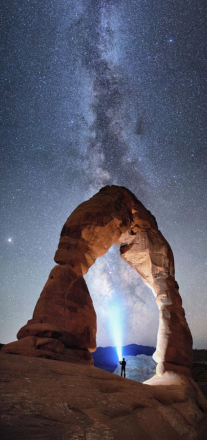
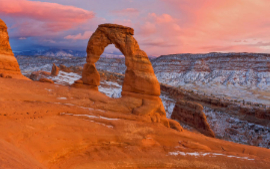
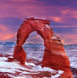
Delicate Arch is a 52-foot-tall (16 m) freestanding natural arch located in Arches National Park, near Moab in Grand County, Utah, United States.
The arch is the most widely recognized landmark in Arches National Park and is depicted on Utah license plates and a postage stamp commemorating Utah's centennial anniversary of admission to the Union in 1996. The Olympic torch relay for the 2002 Winter Olympics passed through the arch.
Because of its distinctive shape, the arch was known as "the Chaps" and "the Schoolmarm's Bloomers" by local cowboys. Many other names have been applied to this arch including "Bloomers Arch", "Marys Bloomers", "Old Maids Bloomers", "Pants Crotch", "Salt Wash Arch", and "School Marms Pants".
The arch was given its current name by Frank Beckwith, leader of the Arches National Monument Scientific Expedition, who explored the area in the winter of 1933–1934. Although there is a rumor that the names of Delicate Arch and Landscape Arch were inadvertently exchanged due to a signage mixup by the National Park Service (NPS), this is false.
This arch played no part in the original designation of the area as a national monument (Arches National Monument) in 1929, and was not included within the original boundaries; it was added when the monument was enlarged in 1938.
In the 1950s, the NPS investigated the possibility of applying a clear plastic coating to the arch to protect it from further erosion and eventual destruction.
The idea was ultimately abandoned as impractical and contrary to NPS principles.
Nature photographer Michael Fatali started a fire under the arch in September 2000 to demonstrate nighttime photography techniques to a group of amateur photographers. The fire discolored portions of the sandstone near the arch. Fatali was placed on probation and fined $10,900 in restitution to the NPS for the cost of cleanup efforts
Delicate Arch is formed of Entrada Sandstone. The original sandstone fin was gradually worn away by weathering and erosion, leaving the arch. Other arches in the park were formed the same way but, due to placement and less dramatic shape, are not as famous.
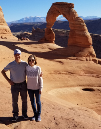
My wife and I visited this great natural phenomenon in November 2020.

Dead Horse Point State Park, Utah
Millions of years of geologic activity created the spectacular views from Dead Horse Point State Park. Deposition of sediments by ancient oceans, freshwater lakes, streams, and wind-blown sand dunes created the rock layers of canyon country. Igneous activity formed the high mountains that rise like cool blue islands out of the hot, dry desert. The park elevated at 5,900 feet, was opened to the public as a state park in 1959.
The plants and animals of Dead Horse Point have adapted to a land of scarce water and extreme temperatures. Plants grow very slowly here. Trees 15 feet tall may be hundreds of years old. The leaves of most plants are small and some have a waxy coating to reduce evaporation. Most desert animals are nocturnal, active only during cooler evenings and mornings. Some have large ears to dissipate heat, while others metabolize water from food.
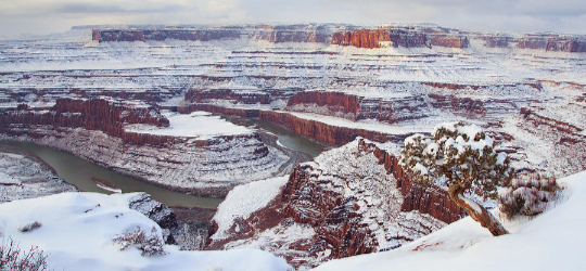
The Legend of Dead Horse Point
Dead Horse Point is a peninsula of rock atop sheer sandstone cliffs. The peninsula is connected to the mesa by a narrow strip of land called the neck. There are many stories about how this high promontory of land received its name.
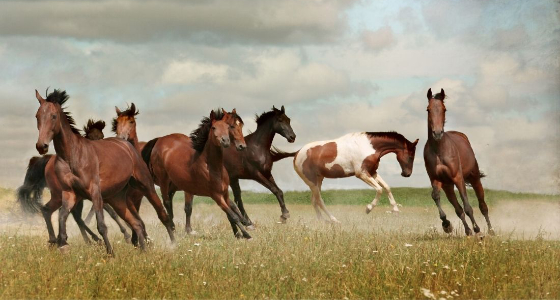
According to one legend, around the turn of the century, the point was used as a corral for wild mustangs roaming the mesa top. Cowboys rounded up these horses, herded them across the narrow neck of land and onto the point. The neck, which is only 30-yards-wide, was then fenced off with branches and brush. This created a natural corral surrounded by precipitous cliffs straight down on all sides, affording no escape.
Cowboys then chose the horses they wanted and let the culls or broomtails go free. One time, for some unknown reason, horses were left corralled on the waterless point where they died of thirst within view of the Colorado River, 2,000 feet below.

Amenities
The park has several overlooks, a visitor center, and picnic areas. The Kayenta Campground has 21 RV campsites with electricity and tent pads. The Wingate Campground features 4 yurts, 20 RV campsites and 11 hike-in tent-only sites.
There are five additional yurts at the Moenkopi Yurt area. A coffee shop serves food and beverages. Dead Horse Point State Park features an 8-mile (13 km) hiking trail that includes loops and overlooks on the East Rim Trail and the West Rim Trail. The Intrepid Trail System contains 17 miles of single-track mountain bike trails with loops of varying levels of difficulty.
Bikes are also allowed single-file on paved roads. Hunting is not allowed in the park. Safety concerns include the relative isolation of the park (gas, food and medical care are over 30 miles (48 km) away in Moab), lightning danger and unfenced cliffs.
Films & Television Shot in Dead Horse Point State Park
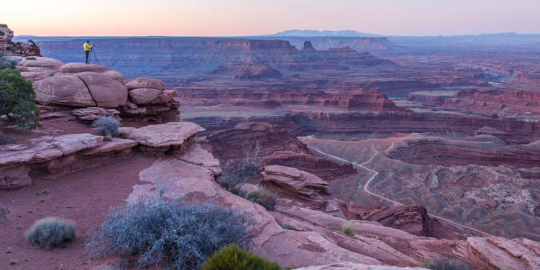

Canyonlands National Park is an American national park located in southeastern Utah near the town of Moab. The park preserves a colorful landscape eroded into numerous canyons, mesas, and buttes by the Colorado River, the Green River, and their respective tributaries. Legislation creating the park was signed into law by President Lyndon Johnson on September 12, 1964.
The park is divided into four districts: the Island in the Sky, the Needles, the Maze, and the combined rivers—the Green and Colorado—which carved two large canyons into the Colorado Plateau. While these areas share a primitive desert atmosphere, each retains its own character. Author Edward Abbey, a frequent visitor, described the Canyonlands as "the most weird, wonderful, magical place on earth—there is nothing else like it anywhere."
History
In the early 1950s, Bates Wilson, then superintendent of Arches National Monument, began exploring the area to the south and west of Moab, Utah. After seeing what is now known as the Needles District of Canyonlands National Park, Wilson began advocating for the establishment of a new national park that would include the Needles. Additional explorations by Wilson and others expanded the areas proposed for inclusion into the new national park to include the confluence of Green and Colorado rivers, the Maze District, and Horseshoe Canyon.
In 1961, Secretary of the Interior Stewart Udall was scheduled to address a conference at Grand Canyon National Park. On his flight to the conference, he flew over the Confluence (where the Colorado and Green rivers meet). The view apparently sparked Udall's interest in Wilson's proposal for a new national park in that area and Udall began promoting the establishment of Canyonlands National Park.
Utah Senator Frank Moss first introduced legislation into Congress to create Canyonlands National Park.
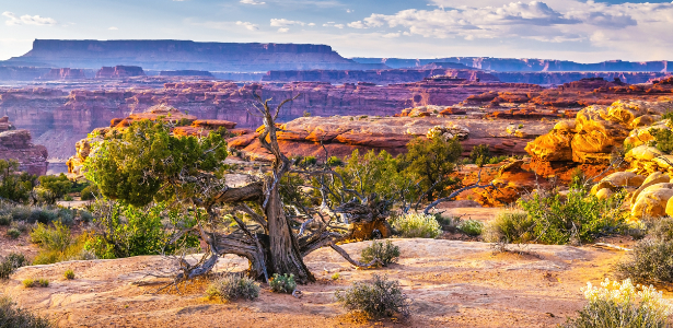
His legislation attempted to satisfy both nature preservationists' and commercial developers' interests. Over the next four years, his proposal was struck down, debated, revised, and reintroduced to Congress many times before being passed and signed into creation.
In September, 1964, after several years of debate, President Lyndon B. Johnson signed Pub.L. 88–590, which established Canyonlands National Park as a new national park. Bates Wilson became the first superintendent of the new park and is often referred to as the "Father of Canyonlands."
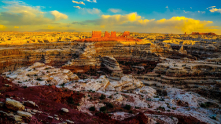
The Colorado River and Green River combine within the park, dividing it into three districts called the Island in the Sky, the Needles, and the Maze. The Colorado River flows through Cataract Canyon below its confluence with the Green River.
The Island in the Sky district is a broad and level mesa in the northern section of the park, between the Colorado and Green rivers. The district has many viewpoints overlooking the White Rim, a sandstone bench 1,200 feet (370 m) below the Island, and the rivers, which are another 1,000 feet (300 m) below the White Rim.
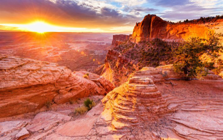
The Needles district is located south of the Island in the Sky, on the east side of the Colorado River. The district is named for the red and white banded rock pinnacles which are a major feature of the area. Various other naturally sculpted rock formations are also within this district, including grabens, potholes, and arches.
Unlike Arches National Park, where many arches are accessible by short to moderate hikes, most of the arches in the Needles district lie in backcountry canyons, requiring long hikes or four-wheel drive trips to reach them. The Ancestral Puebloans inhabited this area and some of their stone and mud dwellings are well-preserved, although the items and tools they used were mostly removed by looters.[15] The Ancestral Puebloans also created rock art in the form of petroglyphs, most notably on Newspaper Rock along the Needles access road.
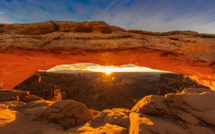
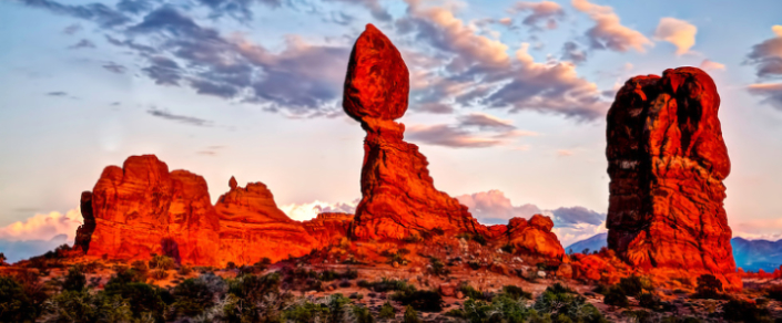
Balanced Rock, one of the most iconic features in the park, stands a staggering 128 feet (39m) tall. While this formation may appear to be an epic balancing act, it’s actually not balanced at all. The slick rock boulder of Entrada Sandstone sits attached to its eroding pedestal of Dewey Bridge mudstone. The exposure of these two rock strata layers are ideal for the formation of arches and balanced rocks.
Balanced Rock defies gravity but this won’t always be the case. Eventually, the 3,600 ton (over 4 million kg) boulder will come tumbling down as the erosional process continues to shape the landscape. In the winter of 1975-76, Balanced Rock’s smaller sibling “Chip-Off-the-Old-Block” collapsed, proving that there is no better time than the present to see this awe-inspiring giant.
At sunset, Balanced Rock becomes saturated in a deep red-orange making it a great place to end a fun-filled day in the park. This is also an ideal place for stargazing and night photography. Its location is just far enough from the city lights of Moab, Utah and provides whimsical rocky spires in the foreground.
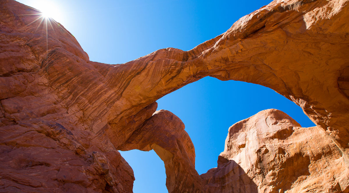 Double Arch and Turret Arch
Double Arch is in The Windows Section, which is considered by some to be the beating heart of Arches National Park. The area contains a large concentration of arches and is one of the most scenic locations in the park. North Window, Turret Arch, and Double Arch are just a few of the awe-inspiring expanses you’ll find in just over two square miles. Other named features in this area include Garden of Eden, Elephant Butte, and Parade of Elephants.
Double Arch takes its name because of it consists of two arches that share the same stone as a foundation for both of their outer legs. Double Arch was formed by downward water erosion from atop the sandstone, rather than from side-to-side water erosion.
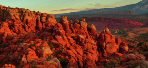
The Fiery Furnace is a collection of narrow sandstone canyons, fins and natural arches located near the center of Arches National Park in Utah, United States. The area is a popular hiking destination that was named for the reddish hue it exhibits in sunset light.
The Fiery Furnace contains a variety of plant species, including one of the largest known concentrations of Canyonlands biscuitroot. Fragile ecological features such as biological soil crust and ephemeral pools are also found within the Fiery Furnace, and are vulnerable to visitor impact. Arches National Park has more than 2,000 cataloged sandstone arches, with some being located in the Fiery Furnace, including Walk Through Arch, Crawl Through Arch, Skull Arch, Kissing Turtles Arch, and Surprise Arch.
Due to the environmental impacts of heavy visitation, the National Park Service initiated a permit system in 1994 to limit access to the Fiery Furnace. Visitors may purchase permits to hike in the Fiery Furnace alone or join a ranger-guided tour. Two trails lead hikers from the parking lot into the Fiery Furnace, but once inside, hikers must navigate the trailless labyrinth of rock formations. To minimize impact on the plant communities, visitors must walk along sandy washes or on sandstone surfaces.
During the approximately 2 mi (3.2 km) ranger-guided tour, which lasts about three hours, visitors will encounter uneven terrain, drop-offs, and narrow passages. Rangers describe the history of the area, while noting the most prominent arches and other geologic features. Visitors can also choose to obtain a self-guided permit and hike through the Fiery Furnace on their own; however, they are required to watch an orientation video describing the area and how to minimize their impact.

The La Sal Mountains or La Sal Range are a mountain range located in Grand and San Juan counties in the U.S. state of Utah, along the border with Colorado. The range rises above and southeast of Moab and north of the town of La Sal. This range is part of the Manti-La Sal National Forest and the southern Rocky Mountains.
The maximum elevation is at Mount Peale, reaching 12,721 feet (3,877 m) above sea level.
The range contains three clusters of peaks separated by passes. The peaks span a distance of about 10 miles (16 km). The name of the range dates to Spanish times, when the Sierra La Sal (meaning the "Salt Mountains") were a prominent landmark on the Old Spanish Trail between Santa Fe and Los Angeles.
Geology
The range formed as a result of intrusion of igneous rocks and subsequent erosion of the surrounding less-resistant sedimentary rocks. The most abundant igneous rocks are porphyritic, with phenocrysts of hornblende and plagioclase: these rocks are called diorite in some accounts but trachyte in at least one other source.
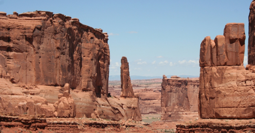 Syenite, some containing the unusual mineral nosean, makes up a few percent of the igneous rocks present. Some of the igneous intrusions have the shapes of laccoliths. Ages of these igneous rocks fall in the interval 25 to 28 million years. The magmas were emplaced into sedimentary rocks with ages from Permian to Cretaceous. The La Sal Mountains rises high over the surrounding Colorado Plateau.
Two other ranges on the Plateau, the Abajo Mountains and the Henry Mountains, formed around igneous intrusions of about the same age. Yet other nearby ranges, such as the Carrizo Mountains and Ute Mountain, formed about otherwise similar intrusions emplaced about 70 million years ago. Formation of these igneous rocks in two distinct time intervals has attracted the interest of scientists seeking explanations for magma production below relatively stable parts of the Earth's crust.
 Devil's Garden
Devils Garden is an area of Arches National Park, located near Moab, Utah, United States, that features a series of rock fins and arches formed by erosion. The Devils Garden Trail, including more primitive sections and spurs, meanders through the area for 7.2 mi (11.6 km).
The trailhead leads directly to Landscape Arch after a 0.8 mi (1.3 km) outbound hike, while Tunnel Arch and Pine Tree Arch can be seen on spur trails on the way to Landscape Arch. Several other arches, including Partition, Navajo, Double O, and Private Arch, as well as the Dark Angel monolith and Fin Canyon, are accessed via the primitive loop trail and its spurs.
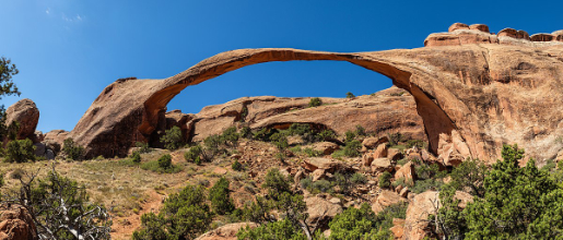 Wall Arch, before its collapse in 2008, was also located in Devils Garden just north of Landscape Arch. Black Arch is visible as a dark outline from the primitive trail and can be approached via an unmarked sidetrack. The trailhead for Devils Garden is located at the end of the main park road. A campground and amphitheater are also available at the site.
History
In the early 1920s, an immigrant prospector from Hungary named Alexander Ringhoffer came across the Klondike Bluffs, a similar area with fins and arches to the west of Salt Valley, which he named Devil's Garden.
Ringhoffer contacted officials at the Denver and Rio Grande Western Railroad to determine whether the land could become a tourist attraction. The railroad company realized the lucrative potential of the area and contacted the National Park Service to consider making it a national monument.
 President Herbert Hoover signed an executive order on April 12, 1929 that created Arches National Monument. The monument originally consisted of two parts: the Windows and Devils Garden, with the latter name being taken from Ringhoffer's name for the Klondike Bluffs, an area not initially included in the park. Arches remained a national monument until 1971 when Congress passed a bill that re-designated it as a national park.
Geography
The Devils Garden trailhead and campground are located 18 mi (29 km) from the park's entrance station at the end of the main park road. The trail through the Devils Garden, including the primitive loop section and spurs, has a total length of 7.2 mi (11.6 km).
The primary trail to Landscape Arch is a graded gravel path, while the primitive loop trail, which begins and ends at Landscape Arch, is more challenging with steep, sloping surfaces and close proximity to drop-offs. Landscape Arch, with the longest span of any natural arch in North America, is reached after a 0.8 mi (1.3 km) outbound hike, while Tunnel Arch and Pine Tree Arch can be seen on short spur trails located along the trail to Landscape Arch.
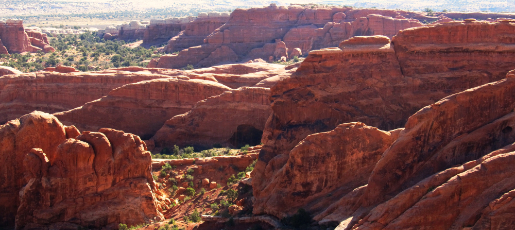 Several other arches, including Partition, Navajo, Double O, and Private Arch, as well as the Dark Angel monolith and Fin Canyon, are accessed via the primitive loop trail and its spurs. Wall Arch, before its collapse in 2008, was also located in Devils Garden just north of Landscape Arch.
 Park Avenue
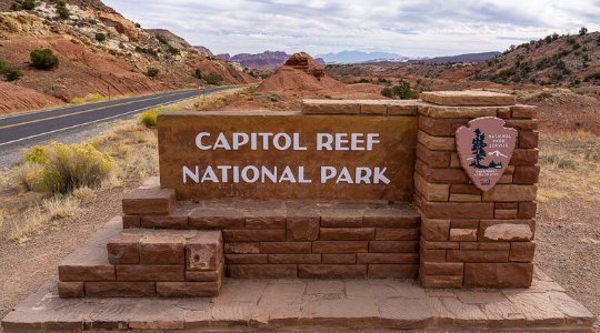
Capitol Reef National Park
Capitol Reef National Park is an American national park in south-central Utah. The park is approximately 60 miles (97 km) long on its north–south axis and just 6 miles (9.7 km) wide on average. The park was established in 1971[3] to preserve 241,904 acres (377.98 sq mi; 97,895.08 ha; 978.95 km2) of desert landscape and is open all year, with May through September being the highest visitation months.
Partially in Wayne County, Utah, the area was originally named "Wayne Wonderland" in the 1920s by local boosters Ephraim P. Pectol and Joseph S. Hickman. Capitol Reef National Park was designated a national monument on August 2, 1937, by President Franklin D. Roosevelt to protect the area's colorful canyons, ridges, buttes, and monoliths; however, it was not until 1950 that the area officially opened to the public.
 Road access was improved in 1962 with the construction of State Route 24 through the Fremont River Canyon.
The majority of the nearly 100 mi (160 km) long up-thrust formation called the Waterpocket Fold—a rocky spine extending from Thousand Lake Mountain to Lake Powell—is preserved within the park. Capitol Reef is an especially rugged and spectacular segment of the Waterpocket Fold by the Fremont River.
The park was named for its whitish Navajo Sandstone cliffs with dome formations—similar to the white domes often placed on capitol buildings—that run from the Fremont River to Pleasant Creek on the Waterpocket Fold. Locally, reef refers to any rocky barrier to land travel, just as ocean reefs are barriers to sea travel.
Geography
Capitol Reef encompasses the Waterpocket Fold, a warp in the earth's crust that is 65 million years old. It is the largest exposed monocline in North America. In this fold, newer and older layers of earth folded over each other in an S-shape. This warp, probably caused by the same colliding continental plates that created the Rocky Mountains, has weathered and eroded over millennia to expose layers of rock and fossils.
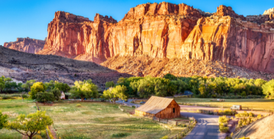
The park is filled with brilliantly colored sandstone cliffs, gleaming white domes, and contrasting layers of stone and earth. The area was named for a line of white domes and cliffs of Navajo Sandstone, each of which looks somewhat like the United States Capitol building, that run from the Fremont River to Pleasant Creek on the Waterpocket Fold.
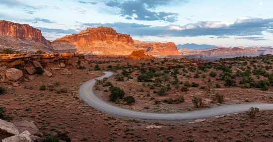
Geography - Continued
The fold forms a north-to-south barrier that has barely been breached by roads. Early settlers referred to parallel impassable ridges as "reefs", from which the park gets the second half of its name. The first paved road was constructed through the area in 1962. State Route 24 cuts through the park traveling east and west between Canyonlands National Park and Bryce Canyon National Park, but few other paved roads invade the rugged landscape.
The park is filled with canyons, cliffs, towers, domes, and arches. The Fremont River has cut canyons through parts of the Waterpocket Fold, but most of the park is arid desert. A scenic drive shows park visitors some highlights, but it runs only a few miles from the main highway. Hundreds of miles of trails and unpaved roads lead into the equally scenic backcountry.
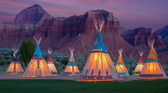
History - Native Americans and Mormons
 Fremont-culture Native Americans lived near the perennial Fremont River in the northern part of the Capitol Reef Waterpocket Fold around the year 1000. They irrigated crops of maize and squash and stored their grain in stone granaries (in part made from the numerous black basalt boulders that litter the area). In the 13th century, all of the Native American cultures in this area underwent sudden change, likely due to a long drought.[8] The Fremont settlements and fields were abandoned.
 Many years after the Fremont left, Paiutes moved into the area. These Numic-speaking people named the Fremont granaries moki huts and thought they were the homes of a race of tiny people or moki.
In 1872 Almon H. Thompson, a geographer attached to United States Army Major John Wesley Powell's expedition, crossed the Waterpocket Fold while exploring the area. Geologist Clarence Dutton later spent several summers studying the area's geology. None of these expeditions explored the Waterpocket Fold to any great extent.
Following the American Civil War, officials of The Church of Jesus Christ of Latter-day Saints in Salt Lake City sought to establish missions in the remotest niches of the Intermountain West. In 1866, a quasi-military expedition of Mormons in pursuit of natives penetrated the high valleys to the west. In the 1870s, settlers moved into these valleys, eventually establishing Loa, Fremont, Lyman, Bicknell, and Torrey.
Mormons settled the Fremont River valley in the 1880s and established Junction (later renamed Fruita), Caineville, and Aldridge. Fruita prospered, Caineville barely survived, and Aldridge died.[5] In addition to farming, lime was extracted from local limestone, and uranium was extracted early in the 20th century. In 1904 the first claim to a uranium mine in the area was staked. The resulting Oyler Mine in Grand Wash produced uranium ore.
By 1920 no more than ten families at one time were sustained by the fertile flood plain of the Fremont River and the land changed ownership over the years. The area remained isolated. The community was later abandoned and later still some buildings were restored by the National Park Service. Kilns once used to produce lime are still in Sulphur Creek and near the campgrounds on Scenic Drive.
