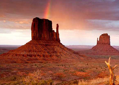
Monument Valley at Arizona and Utah

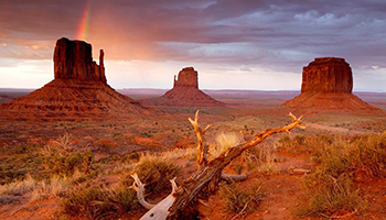
Monument Valley is a region of the Colorado Plateau characterized by a cluster of vast sandstone buttes, the largest reaching 1,000 ft (300 m) above the valley floor. It is located on the Arizona–Utah border (around 36°59′N 110°6′WCoordinates: 36°59′N 110°6′W), near the Four Corners area. The valley lies within the territory of the Navajo Nation Reservation and is accessible from U.S. Highway 163. Monument Valley has been featured in many forms of media since the 1930s.

Director John Ford used the location for a number of his best-known films and thus, in the words of critic Keith Phipps, "its five square miles [13 square kilometers] have defined what decades of moviegoers think of when they imagine the American West."

Attraction Points in Monument Valley spanning 91,696 acres in Utah and ArizonaPlaces to Explore in the Valley (Tse’Bii’Ndzisgaii)

Tribial Park Loop

Be ready to embark on this 17 mile monumental scenic drive. The loop includes 11 numbered viewpoints and you can expect to spend between 2-4 hours in the park. For the best experience, check park hours and arrive early before the 15 mph traffic begins to stack up. You will find the beginning of the loop at the northwest corner of the View Hotel parking lot, near the view cabins.
The viewpoints include:
The Mittens & Merrick Butte
Elephant Butte
Three Sister
John Ford's Point
Totem Pole and Yei Bi Chei and more...

Forrest Gump Point

The location is known most notably as the spot where Forrest Gump ended his cross-country run in the movie. It's also simply an unbelievable view. From the most iconic site within Monument Valley, the Mitten Buttes, take Indian Route 42 East 3.7 miles to the West and turn right onto US-163N.
Drive an additional 8 miles at this point. You will then see a turn-off area on your left, along with a 4 ft wide sign which reads ‘Forrest Gump Hill’. This is the spot. To the south, you’ll see sweeping views of Monument Valley and US-163 shooting straight as an arrow before taking a dramatic right turn, miles down the road.

Valley of the Gods

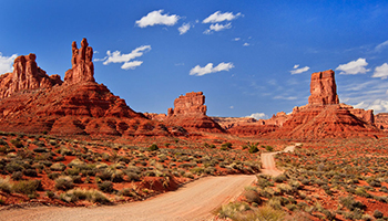
The Valley of the Gods is a scenic sandstone valley near Mexican Hat in San Juan County, southeastern Utah, United States.
Formerly part of Bears Ears National Monument, Valley of the Gods is located north of Monument Valley across the San Juan River and has rock formations similar to those in Monument Valley with tall, reddish brown mesas, buttes, towers and mushroom rocks—remnants of an ancient landscape. The area remains protected public land administered as an Area of Critical Environmental Concern and managed by the Bureau of Land Management, as it was before the monument designation.

Connect with Monument Valley through Social Media


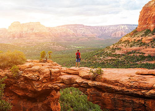
Sedona, Arizona

Sedona is a city that straddles the county line between Coconino and Yavapai counties in the northern Verde Valley region of the U.S. state of Arizona. As of the 2010 census, its population was 10,031. Most of the city lies in Yavapai County, with a portion in the east located in Coconino County. Sedona's main attraction is its array of red sandstone formations. The formations appear to glow in brilliant orange and red when illuminated by the rising or setting sun.

The red rocks form a popular backdrop for many activities, ranging from spiritual pursuits to the hundreds of hiking and mountain biking trails. Sedona was named after Sedona Miller Schnebly (1877–1950), the wife of Theodore Carlton Schnebly, the city's first postmaster, who was celebrated for her hospitality and industriousness. Her mother, Amanda Miller, claimed to have made the name up because "it sounded pretty".

Attraction Points in SedonaPlaces to Explore in Coconino and Yavapai County in Arizona

Crescent Moon Picnic Area

The view of Cathedral Rock and its reflection in Oak Creek in the foreground is one of Sedona’s most iconic images and most often splashed on postcards and tourism promotions. And it’s taken from a lovely forested recreation area called Crescent Moon Picnic Area.

Aside from the peerless view it has picnic tables, BBQ’s, a short hiking trail up to Cathedral Rock, and another of those rare commodities in Sedona otherwise known as shade.
Plus, one of the great selfies the world has to offer. With a bottle of something from your wine tour, one could spend the entire day here sipping, cooking, eating, swimming, and hiking.

The late afternoon ‘Fire Mountain’ is unforgettable and makes for the happiest of Happy Hours. A sight to bring a lump to the throat and cause the soul to soar.

The Vortexes

Yes, grammatically it should be ‘vortices’, but Sedona’s locals say otherwise. The town has become a mecca for New Agers of all ages seeking spiritual growth and wellness. It has become a large high-end business with spas offering services like psychic messages that may cleanse your soul and wallet.

The more economical holistic way is to hike your way to the Sedona’s four vortexes. Many believe the vortexes are special places that emit subtle forms of positive energy that soothes your Inner Self as an alternative form of healing. There isn’t much scientific proof, but millions absolutely swear by it. If your soul ends up channeling a deep seated need of tacos and prickly pear margaritas, not to worry. You’ve had a healthy hike through breathtaking scenery and trod through what has been called The Spiritual Disneyland.

Montezuma’s Petroglyphs

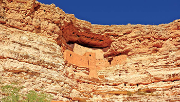
This awe-inspiring cliff dwelling is less than an hour south of town. Like an ancient version of the high-rise condo tower, it was built a millennium ago by the Sinagua (without water) people, farmers mostly but also with the engineering expertise to carve a five-story, fifty room pueblo out of a sheer limestone cliff 90 feet above ground. President Teddy Roosevelt designated it a historic site in 1906. It has nothing to do with the Aztec king after whom it was named by European Americans who mistakenly thought he helped build it. The Sinagua have disappeared, but their monument still holds a commanding presence over the valley, proclaiming the legacy and spirit of the people who built it. Rounding out a memorable day the nearby V-Bar-V Heritage site has a huge, miraculously preserved Sinaguan rock art site with over 1300 petroglyphs featuring human, animal and geometric shapes.

Connect with Sedona through Social Media


O'ahu Honolulu, Hwaii

Oʻahu, anglicized Oahu, known as "The Gathering Place" is the third-largest of the Hawaiian Islands. It is home to roughly one million people—about two-thirds of the population of the U.S. state of Hawaii. The state capital, Honolulu, is on Oʻahu's southeast coast. Including small associated islands such as Ford Island and the islands in Kāneʻohe Bay and off the eastern (windward) coast, its area is 596.7 square miles (1,545.4 km2), making it the 20th-largest island in the United States.

Oʻahu is 44 miles (71 km) long and 30 miles (48 km) across. Its shoreline is 227 miles (365 km) long. The island is composed of two separate shield volcanoes: the Waiʻanae and Koʻolau Ranges, with a broad "valley" or saddle (the central Oʻahu Plain) between them. The highest point is Kaʻala in the Waiʻanae Range, rising to 4,003 feet (1,220 m) above sea level.

Attraction Points in HawaiiPlaces to Explore in the Island of O'ahu, Hawaii

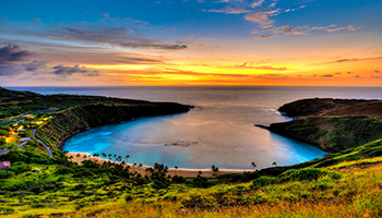
Hanauma Bay

Hanauma is a marine embayment formed within a tuff ring and located along the southeast coast of the Island of Oʻahu in the Hawaii Kai neighborhood of East Honolulu, in the Hawaiian Islands. Hanauma is one of the most popular tourist destinations on the Island and has suffered somewhat from overuse. At one time, this popular tourist destination accommodated over three million visitors per year.
In 1956, dynamite was used to clear portions of the reef to make room for telephone cables linking Hawaii to the west coast of the US. The word hana means bay in the Hawaiian language (the usual addition of bay in its name is thus redundant). There are two etymological interpretations of the second part of its name.

One interpretation derives it from the Hawaiian word for curve, referring to either the shape
of the feature or to the shape of the indigenous canoes that were launched there. Another stems from the indigenous hand-wrestling game known as "Uma".

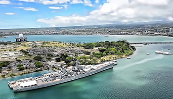
Pearl Harbour

Pearl Harbor is a lagoon harbor on the island of Oahu, Hawaii, west of Honolulu. It has been long visited by the Naval fleet of the United States, before it was acquired from the Hawaiian Kingdom by the U.S. with the signing of the Reciprocity Treaty of 1875. Much of the harbor and surrounding lands is now a United States Navy deep-water naval base. It is also the headquarters of the United States Pacific Fleet. The U.S. government first obtained exclusive use of the inlet and the right to maintain a repair and coaling station for ships here in 1887.
The attack on Pearl Harbor by the Empire of Japan on December 7, 1941, was the immediate cause of the United States' entry into World War II. Pearl Harbor was originally an extensive shallow embayment called Wai Momi (meaning, “Waters of Pearl”) or Puʻuloa (meaning, “long hill”) by the Hawaiians. According to tradition, Keaunui, the head of the powerful Ewa chiefs, is credited with cutting a navigable channel near the present Puʻuloa saltworks, by which he made the estuary, known as "Pearl River," accessible to navigation.

Polynesian Cultural Center

The Polynesian Cultural Center (PCC) is a Polynesian-themed theme park and living museum located in Laie, on the northern shore of Oahu, Hawaii. Owned by The Church of Jesus Christ of Latter-day Saints (LDS Church) and dedicated on October 12, 1963, the PCC occupies 42 acres (17 hectares) owned by nearby Brigham Young University–Hawaii (BYU-Hawaii).
Within eight simulated tropical villages, performers demonstrate various arts and crafts from throughout Polynesia. Seventy percent of the PCC's approximately 1,300 employees are students at BYU-Hawaii.

Since it has opened, the PCC has provided financial assistance to nearly 17,000 young people from more than 70 different countries while they attend BYU-Hawaii. Students may work up to 20 hours per week during school terms and 40 hours during breaks. As a non-profit organization, PCC’s revenue are used for daily operations and to support education.

Waikiki Beach

Waikiki is a neighborhood of Honolulu on the south shore of the island of Oʻahu in the U.S. state of Hawaii. Waikiki is most famous for Waikiki Beach, which is one of six beaches in the district, along with Queen's Beach, Kuhio Beach, Gray's Beach, Fort DeRussy Beach and Kahanamoku Beach. Waikiki Beach is almost entirely man-made. Waikiki is home to public places including Kapiʻolani Park, Fort DeRussy, Kahanamoku Lagoon, Kūhiō Beach Park and Ala Wai Harbor. The Hawaiian language name Waikīkī means spouting fresh water, for springs and streams that fed wetlands that once separated Waikiki from the interior. The area was a retreat for Hawaiian royalty in the 1800s who enjoyed surfing there on early forms of longboards. A few small hotels opened in the 1880s. In 1893, Greek-American George Lycurgus leased the guest house of Allen Herbert and renamed it the "Sans Souci" (French for "without worries") creating one of the first beach resorts. Later that year Robert Louis Stevenson stayed at the resort; subsequently it became a popular destination for mainland tourists.

Kualoa Ranch

Kualoa is a 4000-acre private nature reserve and working cattle ranch, as well as a popular tourist attraction and filming location on the windward coast of Oʻahu in Hawaiʻi. It is located about 24 miles from Honolulu, and 32 miles from Haleiwa. The ranch consists of 3 valleys: Kaʻaʻawa Valley, Kualoa Valley, and Hakipuʻu Valley. The ranch is located on Hawaii State Route 83 between Kaʻaʻawa and Waikane.
The main street address is 49-560 Kamehameha Highway, Kāneʻohe, Hawaiʻi 96744.
The valley was sacred to ancient Hawaiians from the 13th to the 18th century, as Chief Laʻa-mai-kahiki settled there after visiting Kauaʻi before returning to Tahiti. It was also the site of the sacred drums of Kapahuʻula and Kaʻahuʻulapunawai as well as the sacred Hill of Kauakahiakahoʻowaha, the key to the sovereignty of the Kingdom of Oʻahu. As written in the Kumulipo, an ancient Hawaiian genealogical chant, Kualoa is where Papa and Wakea buried their first still born child, Haloa. It is said that the first kalo (taro) plant grew up from where Haloa was buried at Kualoa.

North Shores

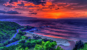
The North Shore, in the context of geography of the Island of Oʻahu, refers to the north-facing coastal area of Oʻahu between Kaʻena Point and Kahuku. The largest settlement is Haleʻiwa. This area is best known for its massive waves, attracting surfers from all around the globe. Every December, the area hosts three competitions, which make up the Triple Crown of Surfing. The three men's competitions are the Hawaiian Pro, the O'Neill World Cup of Surfing, and the Billabong Pipeline Masters. The Pipe Masters was founded in 1971 and is regarded as the sport's top surfing contest. The three women's competitions are the Hawaiian Pro, the Roxy Pro Sunset, and the Billabong Pro on the neighboring island of Maui. Famous Shaved Ice

Connect with Hawaii through Social Media


Cancun, Mexico

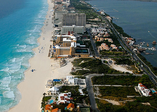
Cancún is a city in southeast Mexico on the northeast coast of the Yucatán Peninsula in the Mexican state of Quintana Roo.
It is a significant tourist destination in Mexico[3] and the seat of the municipality of Benito Juárez. The city is on the Caribbean Sea and is one of Mexico's easternmost points. Cancún is just north of Mexico's Caribbean coast resort band known as the Riviera Maya. In older English-language documents, the city’s name is sometimes spelled "Cancoon", an attempt to convey the sound of the name. There are two possible translations of Cancún, based on the Mayan pronunciation kaan kun.

The first translation is "nest of snakes". The second version and less accepted is "place of the golden snake". The shield of the municipality of Benito Juárez, which represents the city of Cancún, was designed by the Mexican-American artist Joe Vera. It is divided into three parts: the color blue symbolises the Caribbean Sea, the yellow the sand and the red the sun with its rays.

Attraction Points in CancunPlaces to Explore in Cancun and Nearby

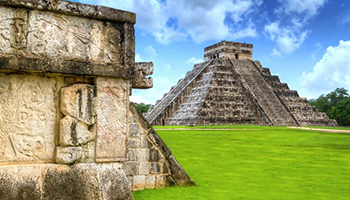
Chichen Itza

Few visitors will want to miss the chance to spend at least a little of their vacation time sightseeing at one or more of the larger Mayan ruins within reach of Cancún. One of the most popular day trips is to Chichén Itzá, three hours west of the beaches and one of Mexico's largest and best-restored archaeological sites. Settled by the Mayans more than 1,000 years ago, this UNESCO World Heritage Site includes many famous Chac-mool statues, along with important buildings such as the 30-meter-tall El Castillo, one of the country's most famous pyramids. If you're an early-riser, you may in fact want to join an early access to Chichen Itza tour accompanied by a private archaeologist. And we do mean early. Hotel pickups are scheduled for 5am, but are worth it for the chance to explore the famous ruins hours before the site opens to other tourists, all the while having your many questions answered by a professional historian. These fun day-long excursions include areas of the site not normally open to the public, a bevy of fascinating facts, a box lunch, and round-trip transportation.

Underwater Museum

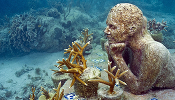
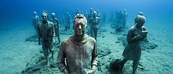
One of the most unusual points of interest in this resort town is the Cancún Underwater Museum (MUSA). Set up in 2009 in the wake of storm damage to the Cancún National Marine Park, this seabed-based attraction is dedicated to the "art of conservation" and is a delight for divers to explore. The core of this unique art collection are the more than 500 sculptures spread across two underwater galleries (a few are located on land in a nearby mall) submerged at depths of between three and six meters and encompassing human figures in a variety of poses (there's even a concrete car).
Put together by six artists from Mexico and Britain, the sculptures will ultimately form the basis for new coral reefs.

Isla Mujeres

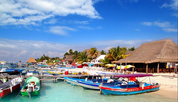
Another destination that is closely associated with Cancún is the lovely Isla Mujeres (the Island of Women). Located about 13 kilometers from the mainland and just a short hydrofoil ride from the pier at the convention center (Cancún Center), this long, skinny island (seven kilometers long and 650 meters wide) is particularly popular among surfers for the larger waves experienced on its east coast, while divers love the abundant marine life surrounding the numerous coral reefs of Garrafon Natural Reef Park. It's also popular with beachgoers who enjoy the less hectic pace; traffic on the island is limited to taxis and buses, all of which are vastly outnumbered by golf carts and scooters. Isla Mujeres is also a popular day trip destination for those staying elsewhere on the Riviera Maya thanks to its many fine restaurants offering excellent views over the water to Cancún. Also popular to explore is Contoy Island (Isla Contoy). Located some 30 kilometers north of Isla Mujeres, this tiny island is now a national park due to its important flora and fauna. A variety of providers offer fun eco-tours and adventures.

El Meco Site

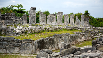
Another interesting Mayan site that is easily accessible from Cancún's main resort area-this one located at the north end of the main beaches-is the El Meco Archaeological Site. Originally inhabited around AD 300, it rose to prominence as a Mayan trade center from the 1100s until its decline after the arrival of the Spanish in the 16th century.
Of particular interest is the 12.5-meter-tall El Castillo, the only pyramid of its kind to have been built in the area. Perched atop the pyramid are the remains of an old temple from which you'll be rewarded with stunning views over the coastline and Isla Mujeres.

El Rey Maya Ruins

If you've room in your Mexico itinerary for another interesting archaeological site, just a few minutes away from the Punta Nizuc end of Cancún are a number of interesting Mayan ruins known as El Rey. Named after a mask found here that was believed to be dedicated to the sun god, the El Rey Ruins (Las Ruinas del Rey) include the remains of some 47 buildings, along with numerous tombs built by the Mayans from AD 900 onwards.
Of particular interest are the two main platforms with their temples, once part of the market, which also served as important ceremonial areas.

Tulum

Tulum, just 90 minutes south, is a better option for those pressed for time. Famous for its cliff-top location and for being the only known fortified Mayan coastal town, Tulum contains many other unique structures in addition to its tall, wide walls, most noticeably its Temple of the Frescos with its sculptures and reliefs depicting seated figures with elaborate headdresses.
The site's largest building, the Castillo, is also its most famous, perched as it is on the cliff-edge overlooking the sea.

Connect with Cancun through Social Media


Story ofBrooklyn
Bridge

The Brooklyn Bridge is a hybrid cable-stayed/suspension bridge in New York City. It connects the boroughs of Manhattan and Brooklyn, spanning the East River. The Brooklyn Bridge has a main span of 1,595.5 feet (486.3 m) and a height of 133 ft (40.5 m) above Mean High Water. It is one of the oldest roadway bridges in the United States and was the world's first steel-wire suspension bridge, as well as the first fixed crossing across the East River.

The Brooklyn Bridge started construction in 1869 and was completed fourteen years later in 1883. It was originally called the New York and Brooklyn Bridge and the East River Bridge, but it was later dubbed the Brooklyn Bridge. However, it was not named as such until the city government passed a law to that effect in 1915.

Over the years, the Brooklyn Bridge has undergone several reconfigurations; it formerly carried horse-drawn vehicles and elevated railway lines, but now carries vehicular, pedestrian, and bicycle traffic. Commercial vehicles are banned from the bridge. Since opening, the Brooklyn Bridge has become an icon of New York City. It was designated a National Historic Landmark in 1964 and a National Historic Civil Engineering Landmark by the American Society of Civil Engineers in 1972. The Brooklyn Bridge is also a New York City designated landmark.

Construction of the Brooklyn Bridge began on January 2, 1870. The first work entailed the construction of two caissons, upon which the suspension towers would be built. The Brooklyn side's caisson was built at the Webb & Bell shipyard in Greenpoint, Brooklyn, and was launched into the river on March 19, 1870.

Compressed air was pumped into the caisson, and workers entered the space to dig the sediment, until the caisson sank to the bedrock. Once the caisson had reached the desired depth, it was to be filled in with brick piers and concrete. However, due to the unexpectedly high concentration of large boulders atop the riverbed, the Brooklyn caisson took several months to sink at the desired rate. Furthermore, in December 1870, the timber roof of the Brooklyn caisson caught fire, delaying construction further.

The "Great Blowout", as the fire was called, delayed construction for several months, since the holes in the caisson had to be repaired. On March 6, 1871, the repairs were finished and the caisson had reached its final depth of 44.5 feet (13.6 m); it was filled with concrete five days later. Overall, about 264 individuals were estimated to have worked in the caisson every day, but because of high worker turnover, about 2,500 men in total were estimated to have worked in the caisson.

Explore More

New York City

New York is a state located in the Northeastern United States. New York was one of the original thirteen colonies that formed the United States. With an estimated 19.54 million residents in 2018, it is the fourth most populous state. In order to distinguish the state from its city with the same name, it is sometimes referred to as New York State (NYS). The state's most populous city, New York City, makes up over 40% of the state's population. Two-thirds of the state's population lives in the New York metropolitan area, and nearly 40% lives on Long Island.

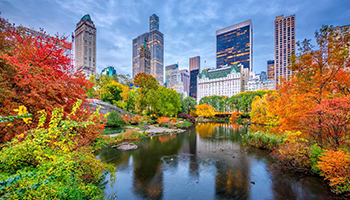
The Great Lawn in the Central Park


The state and city were both named for the 17th-century Duke of York, the future King James II of England. With an estimated population of 8.62 million in 2017, New York City is the most populous city in the United States and the premier gateway for legal immigration to the United States. The New York metropolitan area is one of the most populous in the world. New York City is a global city, home to the United Nations Headquarters, and has been described as the cultural, financial, and media capital of the world, as well as the world's most economically powerful city. The next four most populous cities in the state are Buffalo, Rochester, Yonkers, and Syracuse, while the state capital is Albany.

Attraction Points in New YorkPlaces to Explore in Manhattan, New York

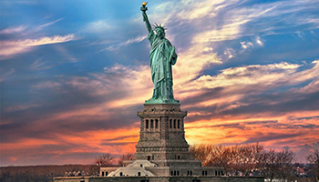
The Statue of Liberty

The Statue of Liberty (Liberty Enlightening the World; French: La Liberté éclairant le monde) is a colossal neoclassical sculpture on Liberty Island in New York Harbor in New York, in the United States. The copper statue, a gift from the people of France to the people of the United States, was designed by French sculptor Frédéric Auguste Bartholdi and its metal framework was built by Gustave Eiffel.

The statue was dedicated on October 28, 1886. The Statue of Liberty is a figure of Libertas, a robed Roman liberty goddess. She holds a torch above her head with her right hand, and in her left hand carries a tabula ansata inscribed in Roman numerals with "JULY IV MDCCLXXVI" (July 4, 1776), the date of the U.S. Declaration of Independence. A broken shackle and chain lie at her feet as she walks forward, commemorating the recent national abolition of slavery.

9 11 Memorial Fountain

The National September 11 Memorial & Museum (also known as the 9/11 Memorial & Museum) is a memorial and museum in New York City commemorating the September 11, 2001 attacks, which killed 2,977 people, and the 1993 World Trade Center bombing, which killed six. The memorial is located at the World Trade Center site, the former location of the Twin Towers that were destroyed during the September 11 attacks. It is operated by a non-profit institution whose mission is to raise funds for, program, and operate the memorial and museum at the World Trade Center site. A dedication ceremony commemorating the tenth anniversary of the attacks was held at the memorial on September 11, 2011, and it opened to the public the following day. The museum was dedicated on May 15, 2014, with remarks from Michael Bloomberg and President Barack Obama. The museum opened to the public on May 21.

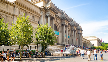
The Metropolitan Museum

The Metropolitan Museum of Art of New York City, colloquially "the Met", is the largest art museum in the United States. With 6,953,927 visitors to its three locations in 2018, it was the third most visited art museum in the world. Its permanent collection contains over two million works, divided among seventeen curatorial departments.
The main building at 1000 Fifth Avenue, along the Museum Mile on the eastern edge of Central Park in Manhattan's Upper East Side, is by area one of the world's largest art galleries. A much smaller second location, The Cloisters at Fort Tryon Park in Upper Manhattan, contains an extensive collection of art, architecture, and artifacts from medieval Europe. On March 18, 2016, the museum opened the Met Breuer museum along Madison Avenue on the Upper East Side; it extends the museum's modern and contemporary art program.

The Central Park

Central Park is an urban park in Manhattan, New York City, located between the Upper West Side and the Upper East Side. Central Park is the most visited urban park in the United States, with an estimated 37.5–38 million visitors annually, and one of the most filmed locations in the world. Central Park is the fifth-largest park in New York City by area, covering 843 acres (3.41 km2).

Central Park was first approved in 1853 as a 778-acre (3.15 km2) park. In 1857, landscape architect Frederick Law Olmsted and architect/landscape designer Calvert Vaux won a design competition to construct the park with a plan they titled the "Greensward Plan". Construction began the same year, and the park's first areas were opened to the public in late 1858.

Additional land at the northern end of Central Park was purchased in 1859, and the park was completed in 1876. After a period of decline in the early 20th century, New York City parks commissioner Robert Moses started a program to clean up Central Park. Another decline in the late 20th century spurred the creation of the Central Park Conservancy in 1980, which refurbished many parts of the park during the 1980s and 1990s.

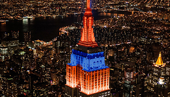
Empire State Building

The Empire State Building is a 102-story Art Deco skyscraper in Midtown Manhattan, New York City. It was designed by Shreve, Lamb & Harmon and completed in 1931. The building has a roof height of 1,250 feet (380 m) and stands a total of 1,454 feet (443.2 m) tall, including its antenna. Its name is derived from "Empire State", the nickname of New York, which is of unknown origin. The Empire State Building stood as the world's tallest building for nearly 40 years until the completion of the World Trade Center's North Tower in Lower Manhattan in late-1970. Following the September 11 attacks in 2001, it was again the tallest building in New York City until the new One World Trade Center surpassed it while under construction in April 2012. As of 2019, the building is the seventh-tallest building in New York City, the sixth-tallest completed skyscraper in the United States, and the 45th-tallest in the world. It is also the sixth-tallest freestanding structure in the Americas.

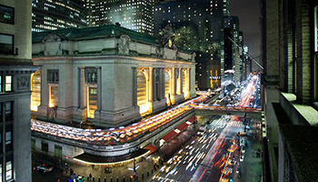
The Grand Central Station

Grand Central Terminal is a commuter rail terminal located at 42nd Street and Park Avenue in Midtown Manhattan, New York City. Grand Central is the southern terminus of the Metro-North Railroad's Harlem, Hudson and New Haven Lines, serving the northern parts of the New York metropolitan area. It also contains a connection to the New York City Subway at Grand Central–42nd Street station.

The terminal is the third-busiest train station in North America, after New York Penn Station and Toronto Union Station. The distinctive architecture and interior design of Grand Central Terminal's station house have earned it several landmark designations, including as a National Historic Landmark. Its Beaux-Arts design incorporates numerous works of art. Grand Central Terminal is one of the world's ten most visited tourist attractions, with 21.9 million visitors in 2013, excluding train and subway passengers.

The terminal's main concourse is often used as a meeting place, and is especially featured in films and television. Grand Central Terminal contains a variety of stores and food vendors, including a food court on its lower-level concourse.

Connect with New York through Social Media